

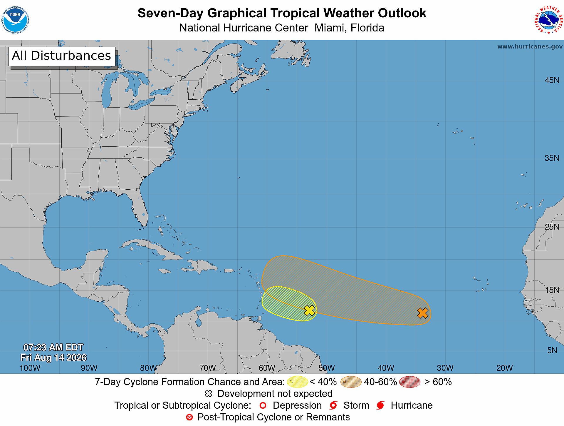
The National Hurricane Center (NHC) is tracking two disturbances in the Atlantic, both of which currently have a low chance of development.
Disturbance 1 is located in the central tropical Atlantic, about 400 miles east of the Windward Islands. The tropical wave is producing gusty winds and a large area of rain and thunderstorms.
NHC said the system is moving into an area with increased winds and dry air, which is expected to limit its potential for development. The disturbance has a 20% chance of cyclone formation over the next seven days.
Disturbance 2 is located in the eastern tropical Atlantic, about 1,000 miles west of the Cabo Verde Islands. The tropical wave is producing rain and thunderstorms and could gradually develop.
NHC said a tropical depression could form this weekend or early next week as the system moves westward or west-northwestward across the central tropical Atlantic. The disturbance has a 30% chance of formation over the next 48 hours and a 50% chance over the next seven days.
Tampa Bay Observer will continue tracking both disturbances and provide updates as conditions change.