

Hurricane Erin weakened to a Category 2 storm Tuesday afternoon but continued to pose significant threats to North Carolina's Outer Banks, where officials have issued evacuation orders and warned of life-threatening storm surge and massive waves that could reach 20 feet.
The first Atlantic hurricane of 2025 has captured meteorologists' attention not just for its rapid intensification over the weekend, when it briefly became a Category 5 storm, but for its enormous size as it approaches the mid-Atlantic coast. Though Erin is forecast to remain offshore, its tropical storm-force winds now extend 230 miles from the center, creating hazardous conditions across a vast area.
As of Tuesday afternoon, Erin had maximum sustained winds of 105 mph and was located about 630 miles southwest of Bermuda and 655 miles south-southeast of Cape Hatteras, North Carolina. The National Hurricane Center issued tropical storm warnings for the Outer Banks from Beaufort Inlet to Duck, North Carolina, including Pamlico Sound, with storm surge warnings in effect from Cape Lookout to Duck.
"Breaking waves of 15 to 20 feet plus coastal flood and storm surge could overwash dunes and flood homes, flood roads and make some communities impassable," said Jamie Rhome, deputy director of the National Hurricane Center. Forecasters warned that storm surge of 2 to 4 feet above ground level could create "a significant threat to life and property" along oceanside areas.
The threat prompted mandatory evacuation orders for visitors to Hatteras Island beginning Monday, with residents ordered to leave Tuesday morning. Dare County officials declared a state of emergency as forecasters warned that portions of Highway 12, the main road connecting the barrier islands, could become impassable for several days due to coastal flooding and overwash.
Erin's development marked one of the most dramatic rapid intensification events on record in the Atlantic basin. The storm jumped from a Category 1 hurricane with 75 mph winds Friday morning to Category 5 status with near 160 mph winds in just over 24 hours Saturday. This placed Erin among only 43 Category 5 hurricanes ever recorded in the Atlantic and made it one of the fastest-strengthening storms in history for this early in the season.
The hurricane's outer bands have already caused significant damage across the Caribbean. In Puerto Rico, Erin's winds and rain knocked out power to about 147,000 customers over the weekend, while the U.S. Virgin Islands and Turks and Caicos Islands experienced tropical storm conditions. The storm is expected to continue affecting the Bahamas before turning northward toward the U.S. coast.
Even as Erin remains hundreds of miles offshore, its influence is being felt along the entire Eastern Seaboard. Dangerous rip currents and high surf have already prompted beach closures from the Carolinas to New Jersey, with more than 50 water rescues reported Monday at Wrightsville Beach, North Carolina alone. Popular coastal destinations including Rehoboth Beach, Delaware, and Wildwood, New Jersey, banned swimming Monday due to rough conditions.
The hurricane's path is being steered by a combination of atmospheric patterns, including a weakening Bermuda High pressure system and a cold front moving off the East Coast. These factors are expected to guide Erin northward between Bermuda and the U.S. mainland, sparing the country a direct hit while still delivering powerful impacts through Wednesday and Thursday.
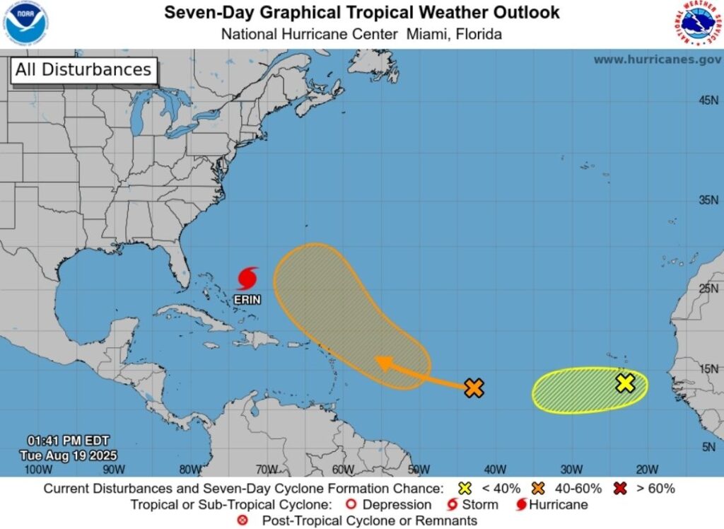
Meteorologists are also monitoring another disturbance in the eastern Atlantic that could develop into a tropical storm later this week. The system, currently producing disorganized showers and thunderstorms near the Cape Verde Islands, has a low probability of development according to the National Hurricane Center, but represents the kind of activity forecasters expect as the season enters its most active period.
The 2025 Atlantic hurricane season was predicted to be above normal, with the National Oceanic and Atmospheric Administration forecasting 13 to 18 named storms. Erin's rapid development from a tropical wave off Africa to a major hurricane demonstrates the volatile conditions present in the Atlantic, where sea surface temperatures remain well above average and wind shear patterns favor storm development.
As Erin continues its northward track, residents and visitors along the mid-Atlantic coast are urged to stay informed about changing conditions and heed all evacuation orders and safety warnings from local officials.